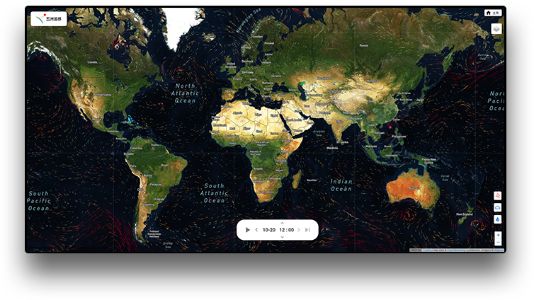
Wuzhou Remote Sensing Tool Platform
Helping you achieve digital transformation and upgrading
Focus on providing universal scenario applications, with high standardization, good flexibility, openness and ease of use, and quick launch.


Weihai Wuzhou Navigation
Connecting everything in the world
On August 7, 2014, Wuzhou Satellite Navigation Technology Co., Ltd. was established in Weihai Nanhai New District with a registered capital of 20 million yuan. Its main business scope includes satellite navigation technology, remote sensing communication technology, and indoor positioning technology. It is a high-tech industry integrating system platform and hardware terminal research and development, production and sales.
Professional team
The company has a sound internal governance structure and is open to cooperation with the world to explore the future together
Continuously let customers experience our sincerity in creating value for each customer
R & D team
We have many mid-level and senior software development and testing engineers with rich development experience. At the same time, we can customize software and hardware according to user needs to fully meet their usage requirements.
Technical experts
Senior industry elites who can professionally analyze the data in the process and propose professional solutions to possible problems.
Product team
Scientific planning, demand implementation, and process control ensure smooth project delivery. Real-time maintenance of customer systems and providing technical support to customers as soon as possible.
Services and Solutions
Wuzhou is committed to providing customers with high-quality services and solutions, further increasing investment in research and innovation, and striving to explore the endless frontiers of science and technology

Smart public transportation system
The Intelligent Public Transport System was developed by Weihai Wuzhou Satellite Navigation Technology Co., Ltd. to provide travel information and assistance to Nanhai passengers and local residents, while easing the dispatch of taxis of Nanhai Public Transport Company and managing their information.

Wind Farm Monitoring System
A wind farm monitoring system is a variation of the displacement monitoring system, specifically designed to monitor environmental changes at wind farms. In addition to raw GNSS and seismograph data, consumer information provided in this system includes seismic shaking, horizontal and vertical displacements, and (estimated) wind speed.

Dam Monitoring System
A variant of the Displacement Monitoring System, the Dam Monitoring System is designed specifically to monitor environmental changes at dams. In addition to GNSS data, other information presented in the system includes water level, temperature, humidity, subsidence and horizontal displacement.

E4G reactive data processing platform
The platform consists of two parts: the seismic station management system is mainly used to manage the management console of the seismic stations; the reactive data processing process, which does not require manual intervention and is used to automatically send calculation results after the API call is triggered.

Remote sensing tool platform
The Remote Sensing Tool Platform involves the parallel processing of massive data sets, primarily in the form of remote sensing image data, but also includes additional geophysical data such as location, climate, and other topological data sources.

Tide Gauge Management System
The tide gauge itself is a physical building on a pier or at least very close to a body of water. It consists of buildings, tide gauge instruments, weather station instruments, GNSS instruments and data logging instruments. This system is used to display the location and sensor data related to the tide gauge.